
2015 Finalist
Book Award Years
Matt Black - The Geography of Poverty
“Marginalized” originally referred to what fell beyond maps of the Roman Empire, but today the word has a different meaning. To be on the edges of the known world now means that your air and water are likely polluted, your roads are in poor condition, your food and medical care are inferior. Poverty is a relative calculation, but it has concrete outcomes: life expectancy, health, education — all are shaped by money and place.
Today, over 45 million people qualify as poor in the US, the largest number ever, earning less than $11,490 annual income for one person or $23,550 for a family of four. At the same time, the share of income going to the top one percent of the population has doubled, rising from nine percent in 1976 to 20 percent in 2011. At the very top, the richest 0.1 percent’s share of the national wealth has tripled.
Income inequality in the US is now on par with Cameroon, Mexico, and China, and nowhere is the country's line between rich and poor as sharp as in California’s Central Valley, the rural, agricultural area where I live. Here, in the heart of the richest state, conditions rival that of any third world nation, with residents suffering some of the country's highest unemployment and hunger rates. This project, combining images, geolocation, and poverty data, seeks to put these marginalized communities on the map, charting this unseen geography of poverty.
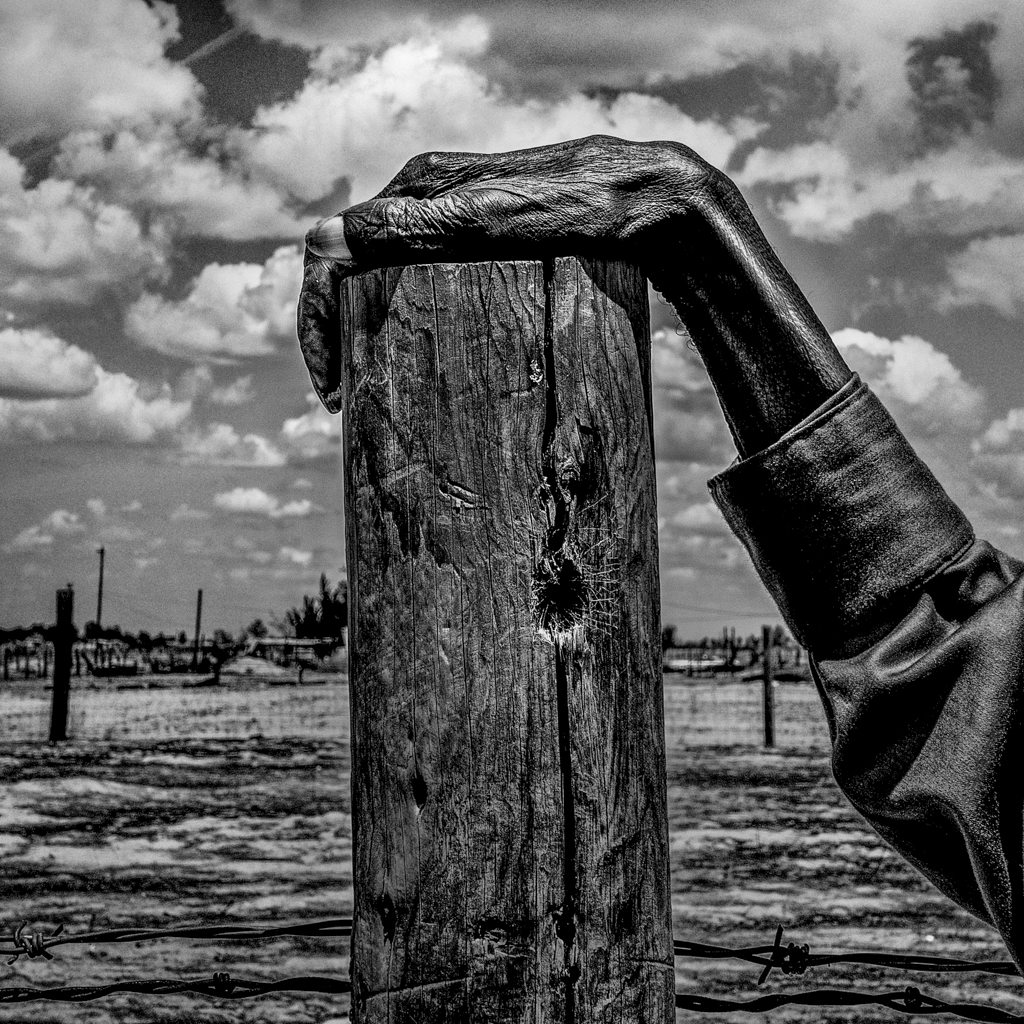
Fence post. Allensworth, CA. 35°51'53"N 119°23'21"W Allensworth is a town in Tulare County, California. The population was 471 at the 2010 census. Residents have a $7,274 per capita income and 54% live below the poverty level.
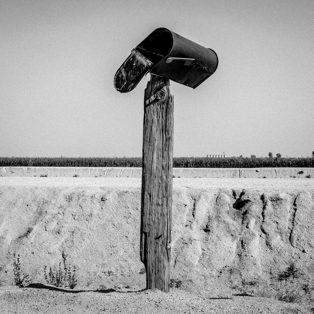
Mailbox. Teviston, CA. 35°55'13"N 119°16'51"W Teviston is a town in Tulare County, California. The population was 1,214 at the 2010 census. Residents have a per capita income of $8,891 and 65.6% live below the poverty level.
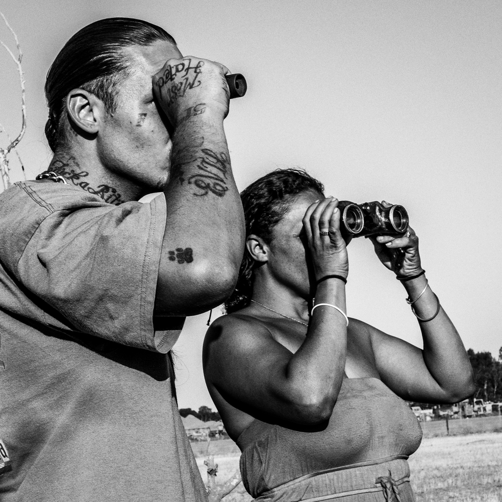
Homeless camp. Fresno, CA. 36°44’45”N 119°46’19”W Fear of eviction and a rash of thefts in the area have increased Sinamon and Aaron's vigilance. They watch as an unidentified man approaches their homeless encampment on the outskirts of Fresno.

Orange grove. Easton, CA. 36°39'0"N 119°47'26"W Easton is a town in Fresno County, California. The population was 2,083 at the 2010 census. 18.8% of its population lives below the poverty level.

Birds. Tulare, CA. 36°12'28"N 119°20'49"W Tulare is a city in Tulare County, California. The population was 59,278 at the 2010 census. Residents have a $18,203 per capita income and 21.4% live below the poverty level.

Homeless camp. Stockton, CA. 36°12'28"N 119°20'49"W Stockton is a city in San Joaquin County, California. The population was 291,707 at the 2010 census. Residents have a $19,906 per capita income, and 24.3% live below the poverty level. In June 2012, the City of Stockton filed for bankruptcy, making it the largest city before Detroit to seek protection from creditors. That same year, the city had 71 murders, giving it the nation's highest per capita homicide rate.
Flea market. Tulare, CA. 36°12'28"N 119°20'49"W Tulare draws its name from the reeds that once lined a nearby lake. Its water was diverted for agriculture and the lake has been dry for nearly fifty years.

Apartment. Pixley, CA. 35°58'7"N 119°17'30"W Pixley is a town in Tulare County, California. The population was 3,310 at the 2010 census. Residents have a $11,585 per capita income and 39.3% live below the poverty level.
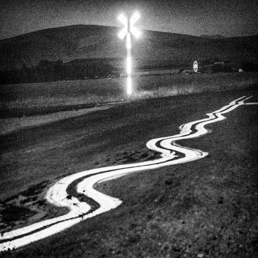
Country road. Lindsay, CA. 36°12’8”N 119°5’17”W Lindsay is a city in Tulare County, California. Residents have a $11,117 per capita income and 40.9% live below the poverty level.

Head of a dead bull hung to dry. Firebaugh, CA. 36°51'22" N 120°27'18" W "California's gonna die." a rancher said. This whole valley's going to blow away like dust."

Guard dog. Mendota, CA. 36°45’13”N 120°22’53”W Mendota is a city in Fresno County, California. Its population was 11,014 at the 2010 census. Residents have a per capita income of $8,947 and 45.6% live below the poverty level.
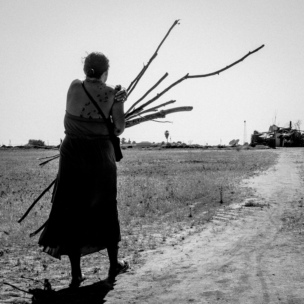 Homeless camp. Fresno, CA. 36°44’45”N 119°46’19”W Sinamon carries firewood to the makeshift home she built in an empty lot just outside of Fresno.